For many of us, Google Earth has always been that digital toy we use to snoop around the neighbors' houses or plan vacations before leaving home. However, the tool has recently taken a considerable leap forward by integrating one of its most beloved and, until now, somewhat hidden features: the flight simulator , which can finally be enjoyed directly from any browser without having to install any unnecessary software on your computer.
This is no small matter, as it involves making a feature that originated back in 2007 as a secret for desktop users accessible to everyone. You no longer need to be a computer expert to take the controls of a virtual airplane and fly over any corner of the planet with just a couple of clicks, taking advantage of the immense visual display that Google has been refining for almost two decades.
How to soar through the skies from the web version
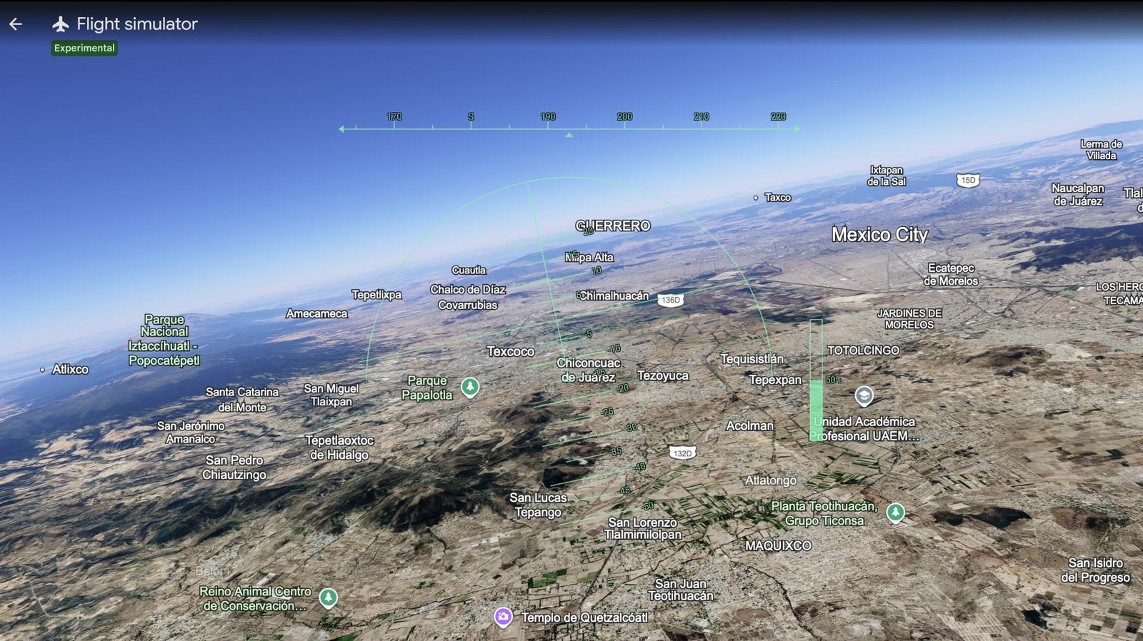
Getting started is quite simple and doesn't require complicated registration. Once you're on the official website, just take a look at the "Explore Earth" button and navigate to the tools section , where you'll find the brand-new simulation option. Activating it transforms the screen into a technical cockpit, allowing you to see the world from a completely different perspective, whether you're taking a stroll around your city or crossing the Alps in no time.
It's important to note that, although the rollout is global, the smoothness of the experience will depend somewhat on your internet connection. For the landscape to look its best, it's recommended to configure the map in satellite mode; this way, the photorealistic images will be projected onto the terrain, and you'll truly feel like you're gliding over the ground and not a flat image.
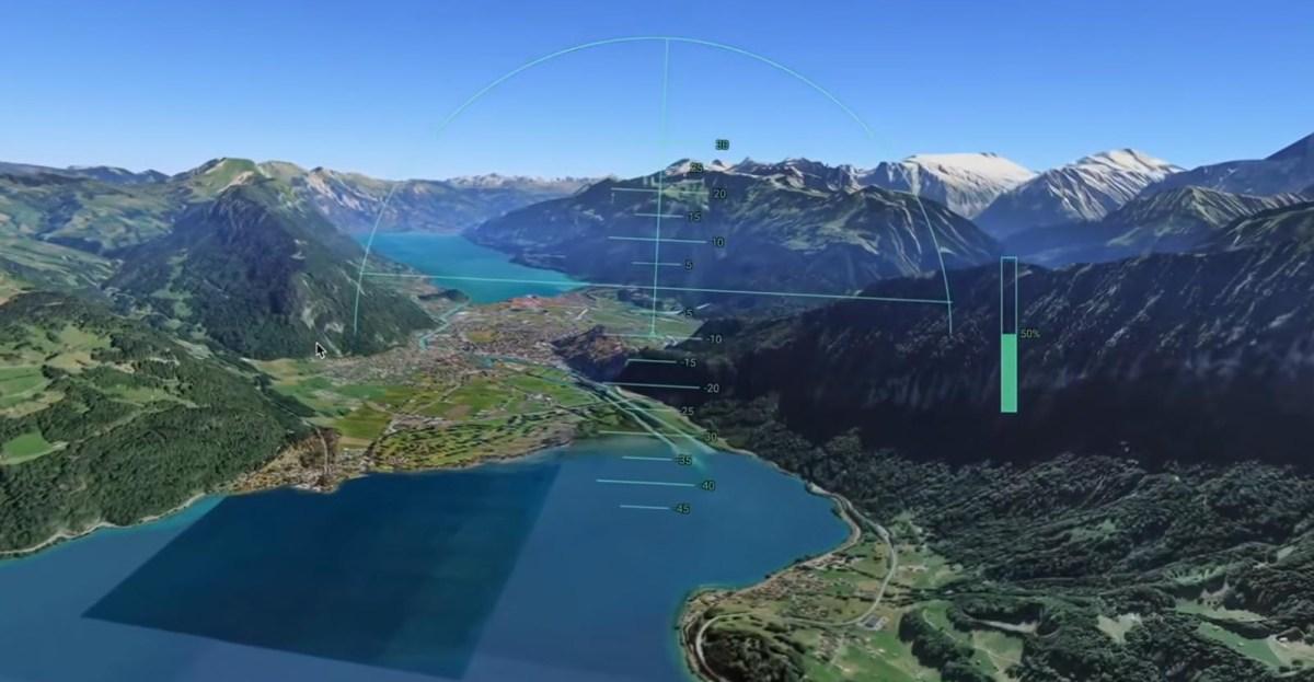
As for the available aircraft, Google hasn't overcomplicated things and offers two very different options: a fast F-16 fighter jet for those in a hurry and a much more relaxed SR-22, ideal for enjoying views of the Spanish coast or European monuments. The controls are based on using the arrow keys for direction, while the Page Up and Page Down keys are used to manage engine power and cruise speed.
If you prefer using a mouse, you can also pilot by clicking on the screen, although it's true that mastering the horizon takes some practice, and at first, it's normal to end up kissing the virtual ground more than once. Luckily, if you crash into a building, the system allows you to restart the flight from a safe altitude so you can get back to your mission without further drama.

Visual realism and technical limitations
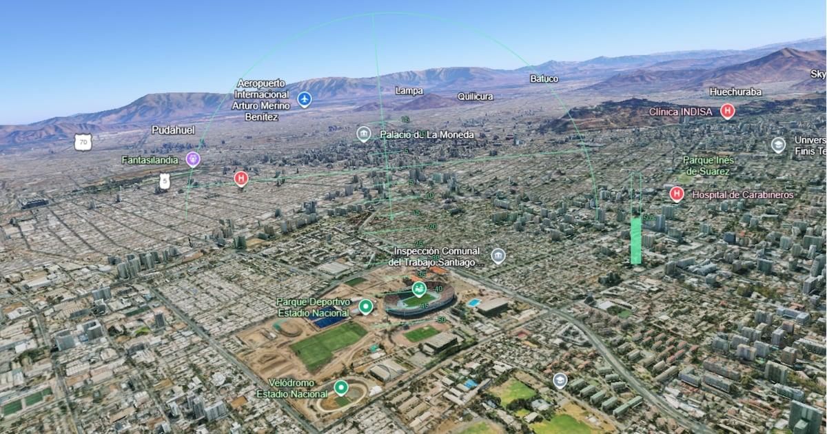
Although it's a very effective feature, we mustn't forget that this isn't meant to compete with professional simulators that cost an arm and a leg. There's no hyper-realistic weather or cockpits with a thousand buttons here; the focus is pure entertainment and exploration , similar to certain virtual reality experiences . It's ideal for seeing how buildings look in 3D from the air or for discovering routes that would be impossible to reach on foot.
One thing to keep in mind is that texture loading in densely populated urban areas can take a while if you're flying at high speed. Therefore, experts advise reducing your speed when flying over cities like Madrid or Barcelona, allowing the browser to process all the details of the streets and squares before you leave them behind.
This update represents a step forward in making mapping technology more engaging, allowing anyone with a decent internet connection and a modern browser like Chrome or Firefox to play pilot for a while. Ultimately, having the world at our fingertips so easily accessible is a real treat, reminding us that exploring the planet can be as educational as it is fun if you have the right tools at hand.
Table of Contents